A Dutch junction that lost its traffic lights, a British ban on new shared space and an American policy adopted in hundreds of places show how differently street design can treat the car.
A living street slows vehicles and favours pedestrians, with the Dutch woonerf as its model. Shared space removes kerbs, markings and signals so users negotiate priority. Complete streets is a policy requiring roads to serve all ages, abilities and modes, from walkers to drivers to buses.
When the town of Drachten in the Netherlands removed traffic lights from one junction, recorded accidents there fell from thirty-six in the four years before to two in the two years after. Yet in July 2018 the British government told councils to halt every new shared space project, with the transport minister saying such schemes "just don't work" for people who are blind or have limited sight.
Both facts are true, and together they show why street design remains one of the most argued-over parts of motoring. Living streets, shared space and complete streets all ask whether a road is a conduit for cars or a place for people, but they answer it in three quite different ways.
What is a living street, or woonerf?
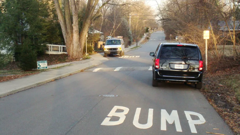
A living street, also called a residential street, is designed first for pedestrians and cyclists. It works as a social space where children can play and neighbours meet on a human scale, with equal access for older and disabled people. Motor vehicles are still allowed, but the design aims to cut their speed and dominance, and with that comes more room for public transport.
The method is the shared space approach: fewer lines between cars and people on foot, one cohesive space instead of segregated strips, and parking confined to marked bays. The principles became popular in the Netherlands in the 1970s, and the Dutch word woonerf, literally residential grounds, is often used as another name for a living street.
Greener, cooler, more complete
Living streets combine three ideas. Green streets manage stormwater at its source with permeable pavements, bioswales planted in engineered soil and street trees that soak up rain and shade the road. Cool streets tackle the urban heat island. Dark impervious surfaces absorb the sun's energy, raise local temperatures and drive up demand for air conditioning, so lighter-coloured paving, rain gardens and planter boxes help, and the more reflective surface even lets street lights run lower-wattage bulbs. Complete streets, the third part, are treated below.
The urban design professor Donald Appleyard laid the intellectual groundwork in the 1970s. A Federal Highway Administration study he conducted covered 500 homes around San Francisco and set them against street designs abroad, and found residents deterred by fast vehicles, noise and pollution, while streets with lighter traffic had more social interaction and a stronger sense of privacy. It inspired San Francisco's 1971 Urban Design Plan and its idea of the protected residential area. Two researchers, Trantle and Doyle, later suggested that woonerfs raise traffic safety and make children more likely to play near the street.
Take away the signs and drivers slow down, but not everyone feels safer for it.
How American street design arrived at the same question
American planners have wrestled with congestion and safety since the late nineteenth century. In the 1920s worries about motor vehicles produced the neighbourhood unit, an idea behind the Radburn plan of Henry Wright and Clarence Stein and Clarence Perry's 1933 proposal, both meant to keep traffic off residential streets. In the 1930s and 1940s the Federal Housing Administration's Community Builders Handbook set out a hierarchy of arterial, collector and minor access streets, and cul-de-sacs and diverters appeared in towns including Montclair and Grand Rapids so that streets behaved as labelled.
The 1950s and 1960s brought housing and highway projects that favoured the flow of motor vehicles. Colin Buchanan's Traffic in Towns, published in England in 1963, introduced the idea of environmental areas where pedestrians are safe from vehicles, and it influenced design in Sweden, Australia and San Francisco.
Shared space street design: removing the rules
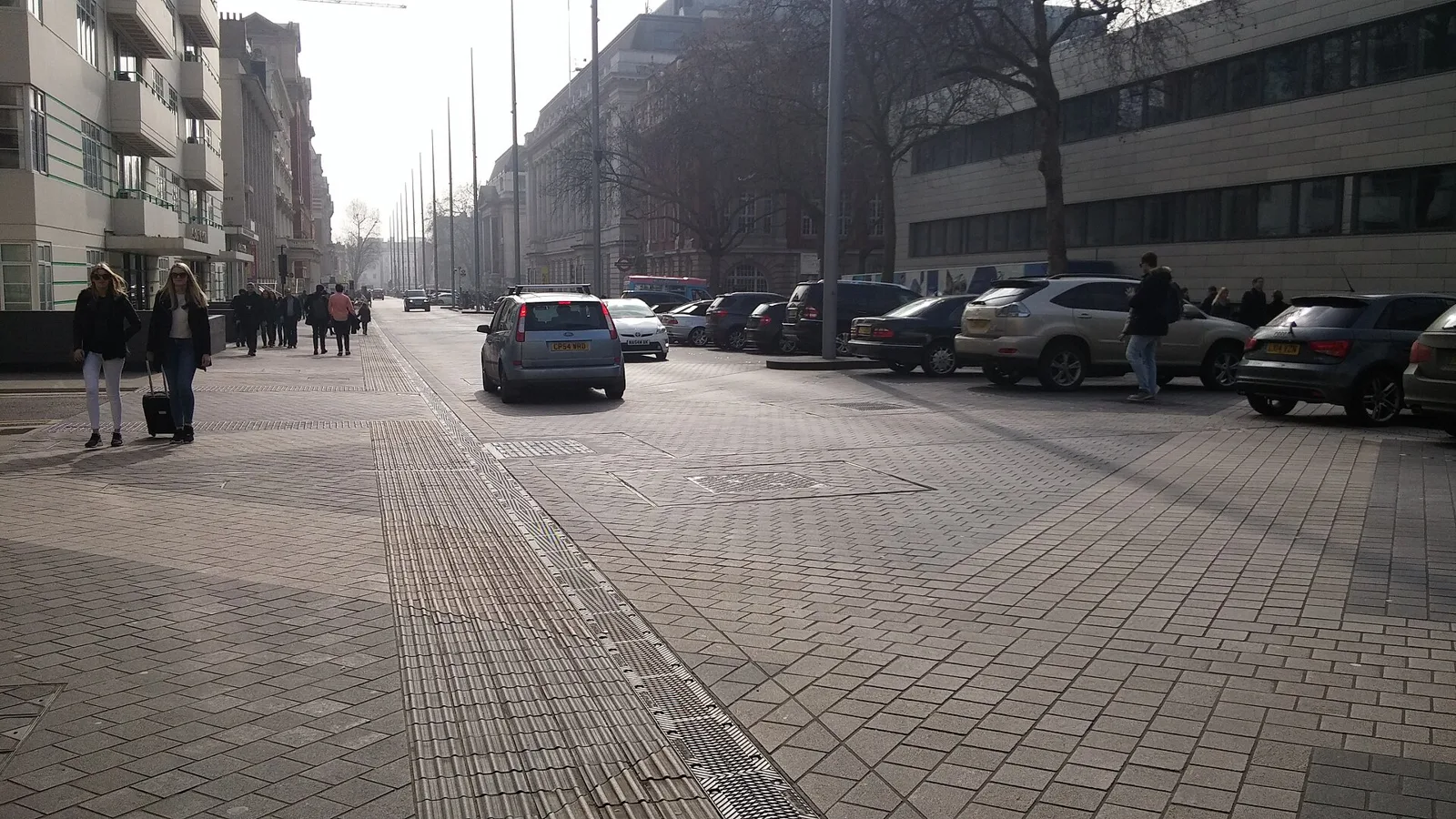
Shared space minimises the separation between types of road user by removing features such as kerbs, road markings, signs and signals. Hans Monderman and others argued that creating uncertainty about priority makes drivers slow down, which reduces vehicle dominance and casualty rates. As a rule it appears in near car-free centres, which the Dutch call autoluw, and in living streets inside residential areas. On busier roads the idea is more controversial.
Monderman, a Dutch traffic engineer, pioneered it in Friesland. In France, Michel Deronzier had used the phrase pedestrian priority in Chambery from the 1980s, and Tim Pharoah used shared space for informal layouts without markings in Devon's 1991 guidelines. Ben Hamilton-Baillie spread the term after 2003. The European Shared Space project, part of an Interreg programme for the North Sea region, developed policies for public spaces between 2004 and 2008 under Monderman, who led it until his death in 2008.
The reasoning rests on human behaviour. Monderman held that the built environment shapes behaviour more than signs and regulations do, and the risk compensation effect may explain why less regulation can mean safer roads. When no one is sure who has right of way, he said, people look for eye contact, drop their speed and take more care. The Chartered Institution of Highways and Transportation counts three distinct approaches inside the label, and suggests replacing it with pedestrian prioritised streets, informal streets or enhanced streets.
Streets that lost their signs
Drachten is the best-known case. Only three of its original fifteen sets of traffic lights remain, and its main junction carries roughly 22,000 cars each day and rarely sees tailbacks. An evaluation of the Laweiplein scheme, an open square, a roundabout and crossings for pedestrians in place of signals, found traffic flowing steadily at equal speeds for motor vehicles and bicycles, with shorter delays. Recorded accidents fell, though cyclists and motorists felt slightly less safe, which fits the theory of uncertainty, and pedestrians' perceptions stayed the same. Makkinga has no road markings or direction signs at all, and a sign at the town entrance reads Verkeersbordvrij, free of traffic signs.
Elsewhere, Skvallertorget square in Norrkoping, Sweden, swapped zebra crossings and signs for a fountain and benches, and has had no accidents since, with mean speeds down from 21 to 16 km/h (13 to 10 mph). On London's Kensington High Street, a scheme nicknamed naked streets cut casualties from 71 to 40, a fall of 43 per cent over two years of monitoring. Exhibition Road took until 2012 to become a shared space, after a design contest in 2003, litigation and many rounds of community consultation, and Brighton rebuilt New Road beside the Royal Pavilion with only subtle changes of material marking the carriageway.
Other places followed: Bohmte in Germany in September 2007, Graz in Austria in October 2011 (its first) and Auckland, where Wairepo Swamp Walk was completed in mid-2010. Under the Streets as Shared Spaces programme, 65 councils across New South Wales have received support since May 2020. Switzerland takes a different legal route: its law requires that someone have right of way, so the Begegnungszone gives pedestrians priority.
Why shared space is contested
Critics say the evidence is thinner than the enthusiasm. In 2011 Moody and Melia reviewed the research behind British policy and found that claims about pedestrians following their desire lines and about reduced speeds were not justified. Their work in Ashford, Kent suggested that on busy streets pedestrians give way to vehicles more often than the reverse, and most people, especially women and older people, found the layout intimidating. A Hereford study by Hammond and Musselwhite found that where volumes are low and speeds slow anyway, vulnerable users coped more easily, including blind, partially sighted and older people.
Research by the Transport Research Laboratory put the threshold at about 90 vehicles an hour, below which adult pedestrians were happy to mingle with traffic; at 110 an hour they treated the street as an ordinary carriageway. The Dutch cycling body Fietsberaad said speeds fall but that less assertive cyclists often dismount and wait to be given priority.
Disabled people's groups have been the most forceful opponents. A campaign called Say No to Shared Streets, run by Guide Dogs, has the backing of more than thirty other disability organisations, and Mencap, Leonard Cheshire Disability and the Royal National Institute for Deaf People voiced similar worries. Lord Holmes's 2015 report, Accidents by Design, recorded negative experiences from sixty-three per cent of those who responded, and thirty-five per cent said they steered clear of shared space altogether, while wheelchair users said safe crossing points were hard to find. The 2011 national guidance was reversed in 2018. New Zealand, working with disability groups, responded with obstruction-free accessible zones along building lines.
Complete streets: a policy, not a look
Complete streets is a transport policy and design approach that requires roads to be planned, designed, operated and maintained for safe, convenient travel by users of all ages and abilities, whether they walk, cycle, drive, ride transit or deliver goods. The term is used chiefly in the United States and Canada by advocates, planners, engineers and public health practitioners. It grew out of a country in which, after the Second World War, many communities were built around fast access by car.
Oregon passed the first policy of this kind in 1971, and sixteen further state legislatures have since followed. The phrase itself came in 2003, when Barbara McCann, later head of the National Complete Streets Coalition, led a search to replace the term routine accommodation and David Goldberg of Smart Growth America suggested it. The Coalition was founded in 2005. Federal legislation proposed in 2008 and 2009 failed, the US Department of Transportation issued a supportive policy statement in 2010, and by early 2013 more than 490 jurisdictions, including twenty-seven states, had adopted a policy. A federal Complete Streets Act was introduced in Congress in 2019 and 2021.
What a complete street contains
Typical elements are sidewalks, raised crosswalks and median islands, traffic-calming measures such as road diets and shorter curb corners, protected bike lanes and bus lanes with transit signal priority. Policies usually allow three exceptions: freeways and other roads where non-motorised travel is banned, roads where the cost would be out of proportion to the need, and roads with no present or future need.
Examples are specific. Orlando cut Edgewater Drive from four lanes to three with bike lanes, and crashes fell 35 per cent while cycling rose 23 per cent and walking 30 per cent. On New York's Select Bus Service routes, bus speeds rose 20 per cent and ridership 10 per cent, and retail sales on Fordham Road rose 71 per cent against 23 per cent across the borough. Marin County added bike lanes to Alameda del Prado and saw weekday cyclists up 366 per cent and weekend cyclists up 540 per cent.
Comparing the three approaches
| Approach | Where it took hold | Core method | Who has priority |
|---|---|---|---|
| Living street | Netherlands, popularised in the 1970s | Shared space approach, traffic calming, greenery, parking in bays | Pedestrians over vehicles |
| Shared space | Friesland, Netherlands, under Hans Monderman | Remove kerbs, markings, signs and signals so users negotiate | Settled between users, or by pedestrian priority rules in some countries |
| Complete streets | United States and Canada; Oregon policy of 1971 | Policy requiring every road project to serve all users, with lane reductions, crosswalks and bike and bus lanes | All users, with walking and sustainable travel highest |
The evidence for complete streets, and the objections
A Federal Highway Administration safety review concluded that sidewalks, raised medians, turn controls, better bus stops and lighting and traffic calming make streets safer for pedestrians, cyclists and motorists alike. Pedestrian injuries and deaths fall 88 per cent when sidewalks are added, 69 per cent with hybrid beacon signals and 39 per cent with medians. A University of Oregon before-and-after study of 25 projects found significant reductions in automobile speed crashes.
On health, one study found that among people with a safe place to walk within 10 minutes of home, 43 per cent reached recommended activity levels, as against 27 per cent of those lacking one. On economics, a Lancaster, California, revitalisation created 50 new businesses and over 800 jobs, and after a 2007 redesign Manhattan's 9th Avenue saw retail sales rise nearly 50 per cent. Boulder, Colorado, trimmed its yearly carbon dioxide output by half a million pounds as fewer residents drove alone.
Opponents may see car-only infrastructure as a better use of public money, or treat measures to encourage other modes as coercive, and individual projects have drawn local opposition over traffic flow and access. Critics coined incomplete streets to argue that standardised redesigns ignore local history and character, and some say American engineers fixate on keeping cyclists apart from both walkers and drivers.
What this means for anyone driving
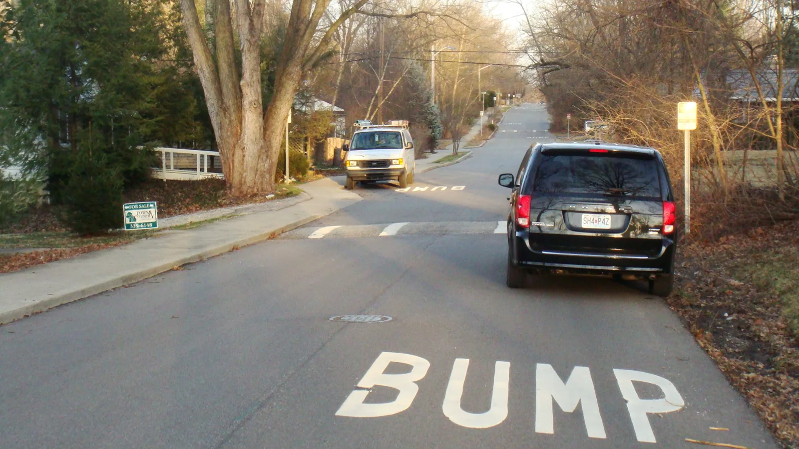
For drivers the changes show up as slower speeds and fewer rules. On a living street cars are guests, and parking is restricted to bays. In a shared space there may be no markings or signals, and in a Swiss encounter zone pedestrians have right of way. On a complete street, a road diet such as Orlando's four lanes to three removes capacity, and opposition is usually based on concerns over traffic flow and car access. Flow matters in shared space too, since pedestrians mingle with traffic below 90 vehicles an hour but not at 110.
Where the three approaches stand now
Shared space and complete streets are still spreading and still disputed. The Streets as Shared Spaces programme in New South Wales dates only from May 2020, and complete streets bills reached Congress in 2019 and 2021 without becoming law. Complete streets advocates also look ahead to technology, saying future autonomous vehicles will cut demand for parking. In Britain, the national position remains the 2018 instruction to halt new shared space projects.